April 1996
Down the Tanner, West along the Escalante Route to New Hance.
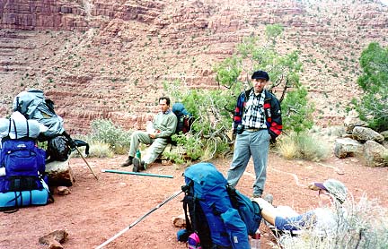
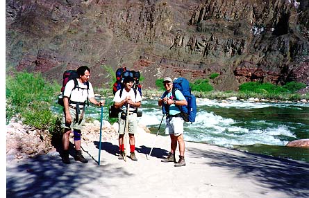
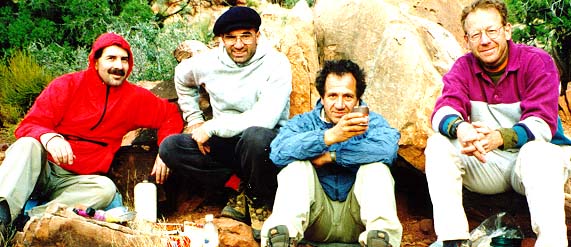
The Hikers, left to right. Gary DeFraia, Tom Ralston, John Avello, Tony Ligamari, Cheech Calenti.
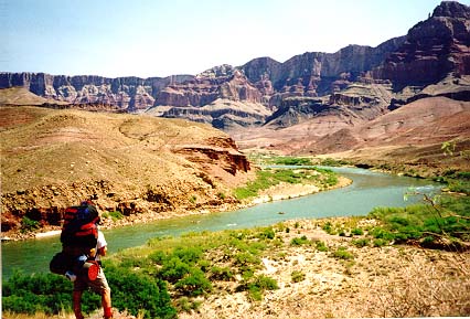
4/17/96. We dropped one car off at Moran Pt. and took the second car to Lipan Pt. The trailhead is on the east side of the parking lot, clearly marked with a large sign warning of the many dangers of hiking in the canyon. The trail drops quickly through the upper layers of canyon rocks and levels out for the first time in the Supai, just east of 75 mile creek. We lost the trail here momentarily, since we had our eye out for a vista on which to take a break and didn't realize that the trail actually goes down to the right of this ridge. Anyway, the ridge is a nice place to stop for a break. It takes about an hour and a half to get there. We continued on and decided to camp right on the bluff just north of where the trail takes a sharp right hand (east) turn and heads down the Redwall. From the parking lot, it had taken us about 3.5 -4 hours to reach this point. The bluff commands panoramic vistas of the Colorado as it turns west after coming from the north. It was a very windy evening and we all slept in tents just to protect ourselves from the wind.
4/18/96 The next morning we broke camp around 9am and headed
down the Redwall. I was surprised at what a relatively easy descent
it was. It took us three hours to reach the
river from our campsite above the Redwall. It rained for about 20 minutes
during this stretch, but not enough to even bother with rain gear.
It was on this stretch of the Tanner that we met a veteran of canyon
hiking, Don Zeigler. Don was coming up after a week in the inner canyon.
He does occasional work for the Park Service checking on Archeological
sites in various places. Don has done over 1400 miles in the canyon, and
when he casually mentioned that he had been talking to Harvey about a canyon
he was exploring I asked if he meant Harvey Butchart and he said yes. If
you're interested enough in the canyon to be reading my accounts you probably
know who Harvey Butchart is, but for the uninitiated, Harvey is a living
legend among Grand Canyon trekkers. He has hiked more of the Grand Canyon
than any man alive, and probably dead for that matter.
Don told us that after he discovered a William Bass camp that Butchart
had been searching for for years, Butchart was so impressed that he gave
Don a book that the Kolb brothers had given him many years before. Again,
the Kolb brothers are two other legendary Canyon characters, and their
studio still stands on the South Rim.
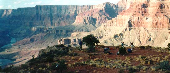
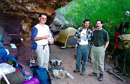
We decided to set up camp under an overhang
just to the east of where the Tanner ends. It offered protection from the
wind, which was whipping up the abundant sand in the area.
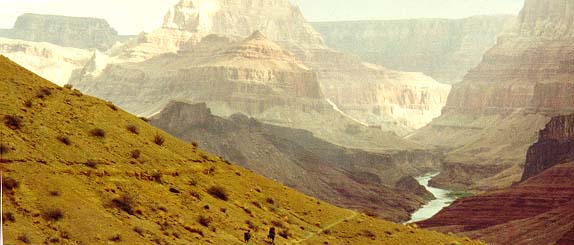
At about 3:30 pm. Tom and I decided to head down the Beemer to see
how far we could get before dark. It was very windy on the bluffs just
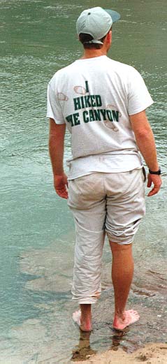
to the east of the Tanner and I lost my hat over the edge. Once we dropped
to river level it was fine and we continued along until we got past the
rather large island that is probably 2.5 - 3 miles up the Beemer. Just
beyond the island there is a very large sand dune. We were hot by then
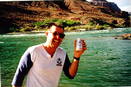
so Tom took off his clothes and jumped in. As he was toweling off I noticed
something floating in the eddy just beyond us. After closer inspection
we decided it was a can of beer, and an upopened one at that! I couldn't
convince Tom to jump in after it but slowly it started drifting towards
us and in 5 minutes it drifted right up to our feet! A
nice, ice cold Bud for two thirsty backpackers at the bottom of the
Grand Canyon! What a commercial this would have made!
4/19/96 - Our plan for this day was
to head across the Escalante Route to the New Hance. We had heard from
both Don Zeigler and another pair of hikers we had met on the Tanner that
the Escalante was very easy to follow,
with very little route finding at all. This made me a little more confident
and sure enough they were right. The Backcountry office desciption of this
route is very straightforward, especially if you are following it in the
same direction for which it is written, east to west. I will include the
description in it's entirety at the end of this account.
The only thing that threw us off at all was how we miscalculated how
long it would take us to walk this darn trail. By 4 pm we had only reached
Escalante Creek, and since there were a number of nice campsites near the
river I wanted to stay. However, I was overruled and we headed west to
75 mile creek. This is a fabulous stretch of hiking! We were skirting the
eastern side of this slot canyon without realizing that it was what we
would be walking through to reach the river. Make sure you don't contour
the creek but rather drop into it when you get to it's head. It's clearly
marked by cairns and if you find yourself on the west side of the canyon
looking into it, you've gone too far.
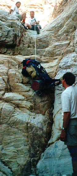
Right after dropping off into the creek, there is a 12
foot cliff. It's best to rope packs down at this point. Our light nylon
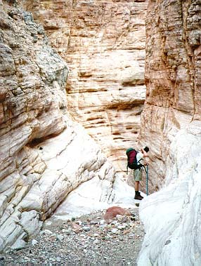
rope worked just fine. Once inside the slot
canyon it twists and turns and drops
5-6 feet at a time in places. It was dry during our trip but if water
was running in this creek there would be no way to stay dry, and if the
water was flowing enough, it would be impassable. Check with the rangers.
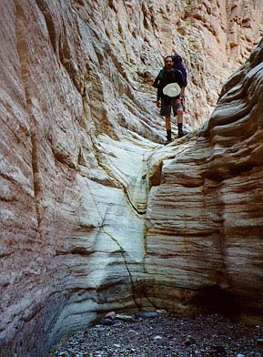
Since the creek twists and turns so much, it's often impossible to
see very far ahead. At one point Tom heard people coming in the other direction
and they were talking about just seeing a mountain lion. Tom scrambled
up a rock and gave his best lion imitation, which is very realistic. Suddenly
he heard two women screaming and running in the opposite direction! He
jumped out and ran around the bend so they could see him, and yelled to
them that he had made the noise and there really wasn't a lion. The two
young couples were so happy to see that there wasn't really a lion blocking
their path that they weren't even angry at Tom for scaring the hell out
of them!
We continued toward the river and camped at the mouth of 75 Mile Creek.
There are nice campsites on both the east and west sides.
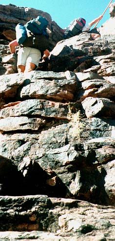
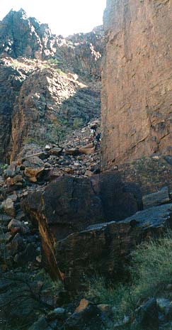
4/20/96 - We broke camp at 8:30am and headed for Papago Creek, taking the high route. My advice here is to take some time before breaking camp and explore the lower route. We probably could have made it from 75 Mile Creek to Papago along the river and it would have been a much easier walk, with just a few minor scrambles. At any point, we reached Papago Creek within an hour and rested while watching some river runners cruise by. The trail gets very interesting at this point. A solid rock cliff juts out into the river and there is just no way to get around it. Don't be deceived into thinking you can just walk, wade or swim this by sticking close to the wall! DO NOT go in the water. The only way to go is up, over and down so look for the cairns immediately on the west side of the creek. It's about a 50 foot climb almost straight up, definitely hand over hand. Tom and John did it with their packs on but the going was slow. Gary, Tony and I took off our packs and handed them up from ledge to ledge until we got to the top. From here the trail climbs upward and westward until the next even more challenging part of the route. The cairns lead to a huge rockslide on the west side of the rock cliff and this is the only way to get down. It's very steep and very loose. Tony led the way and I followed. The other three watched from up above to get some ideas. We proceeded very slowly and made sure of every step. We always leaned into the mountain and were careful not to start a rockslide on the person below us. I'd say this section took us about 15 minutes, though it seemed much longer than that. At the bottom of this scree the trail continues among more large boulders and tamarisks until the mouth of Red Canyon, and New Hance Creek. It took us 2.5 hours to do the stretch from 75 Mile Creek to the New Hance.
We had lunch at the river. There were quite a few parties there, maybe 4, and we had no desire to camp with so many people around. In addition, we wanted to put some time into Red Canyon because we remembered it being a real bear when we had descended it in the fall of '94. We pumped some water and headed out at 12:30pm. Tony and John were pulling up the rear and lost sight of us soon after leaving the river. We didn't give it much thought since we knew there was just one way to go in this canyon and that was along the creek bed. However, we should have been more explicit in our directions because John and Tony thought they were lost and almost turned around and headed back to the river. Gary and I rested at the big rock campsite about 45 minutes up from the mouth of the river and waited, since we needed to make a decision here as to the rest of the days hiking. Tony and John eventually came into view and when they got to us Tony was more than a little upset that we had left them with no directions and out of sight. I'm sure this is why he later stepped on my hiking stick and broke it, but he denies that!
At the rock after much debate we decided to continue up the trail to
the base of the Redwall and camp there. We had heard reports that it was
still very windy in the upper parts of the trail by two hikers who had
been there just a few hours before. Tom wanted to stay where we were, since
there was water and a guaranteed nice campsite. And neither Tom nor I remembered
any terrific campsites when coming down the New Hance the previous year.
Never the less, we continued up because we knew the trail was very difficult
and we wanted to split up the work between two days.
The trail continues up the east side of Red Canyon and it climbs relentlessly.
We never got a break but we did make great time and before long we were
at the top of the Redwall. It was a mere two hours since we had left the
big rock.
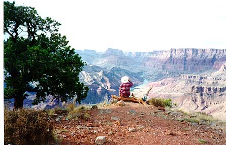
We found three fine sites at the top of the Redwall and set up our tents. The wind never materialized and the evening was clear and cool. We had dinner out on a bluff overlooking a good section of the canyon, and shared the last of our dinners and our refreshments. Our sleeping arrangements for the night were Gary in one tent, Tony and John in the other and Tom and I outside under the stars. It was a gorgeous night.
4/21/96 - We broke camp at 7:45 and reached the rim at 11:45. The New
Hance trail is relentless from start to finish. I've done it both ways
now and would say it's easier going up than coming down, but either way,
I think it's the most difficult of the rim to river trails.
The reasons are many. First, from the river upstream
to where the trail leaves the creek bed, you have to walk in sand, which
is difficult enough, but every so often you have to climb up and around
huge boulders blocking the stream bed. When you finally get out of the
sandy creek bed you breathe a sigh of relief until you realize that the
trail just never levels out, it climbs and climbs until you reach the top
of the Redwall. There is not much Tonto Plateau along the way to give you
a breather. On most rim to river trails, once you top the Redwall you skirt
along the Supai formations, so there are level stretches of hike before
you climb to the next layer of the Supai, and these respites prepare you
for the last climb through the Coconino, Toroweap, and Kaibab.
On the New Hance, there are no long stretches of the Supai, just more
long grunts!
This was an absolutely great trip. Four of us had been close friends from grade school but moved to different parts of the country and while we had kept in touch, we never all four of us had been together at the same time in about 20 years! It was a wonderful mix of catching up on each others lives and laughing regularly at some of the antics of our youth. It was also the first spring trip where it hadn't rained on us for 2 straight days.
We headed to the showers and then to El Tovar for lunch. John and Tony then headed west to Las Vegas and the rest of us headed south to Tucson.