Fall Trip: October 3
October 6, 2003
South Bass, Tonto and
Boucher Trails
Trip Report by Gary DeFraia
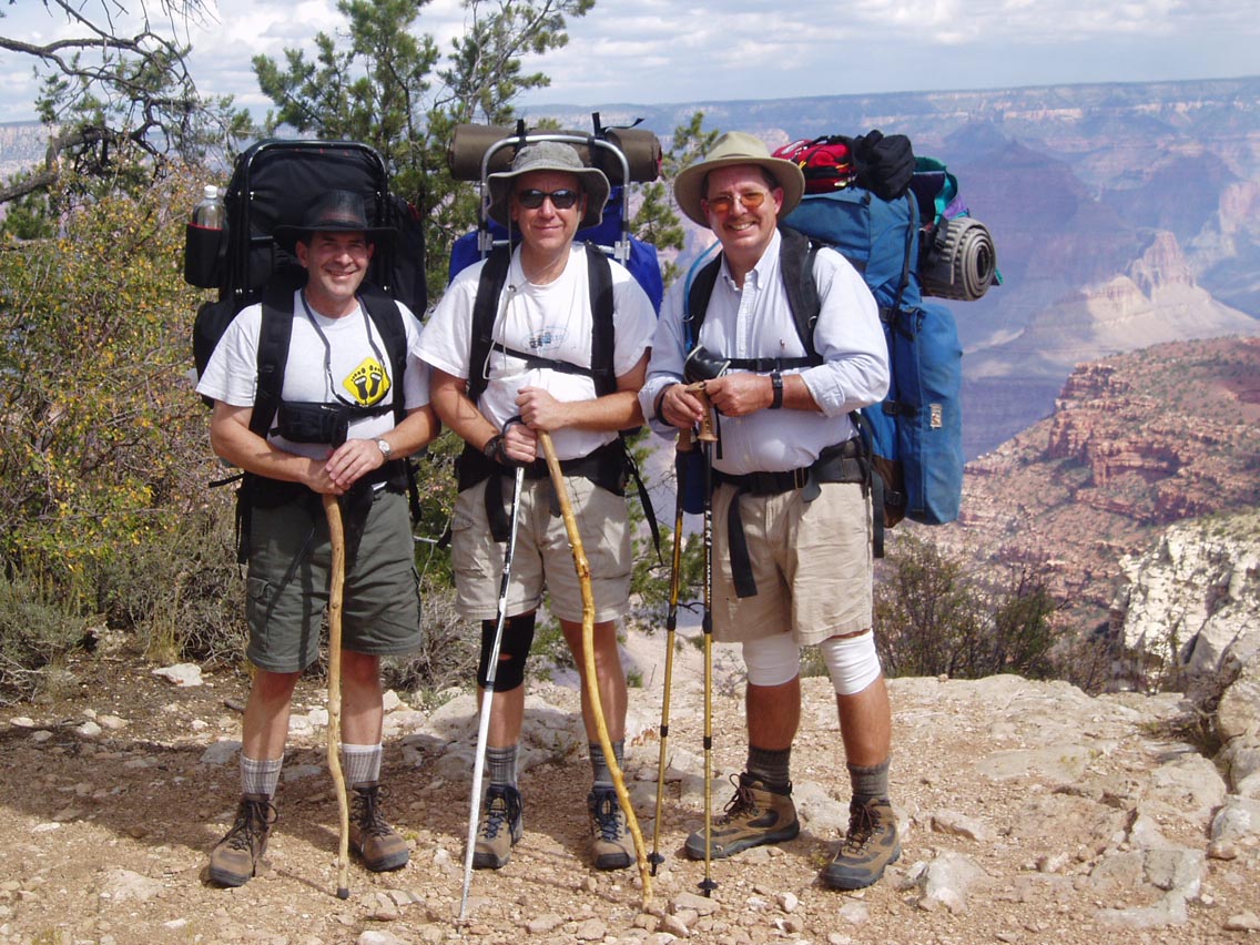
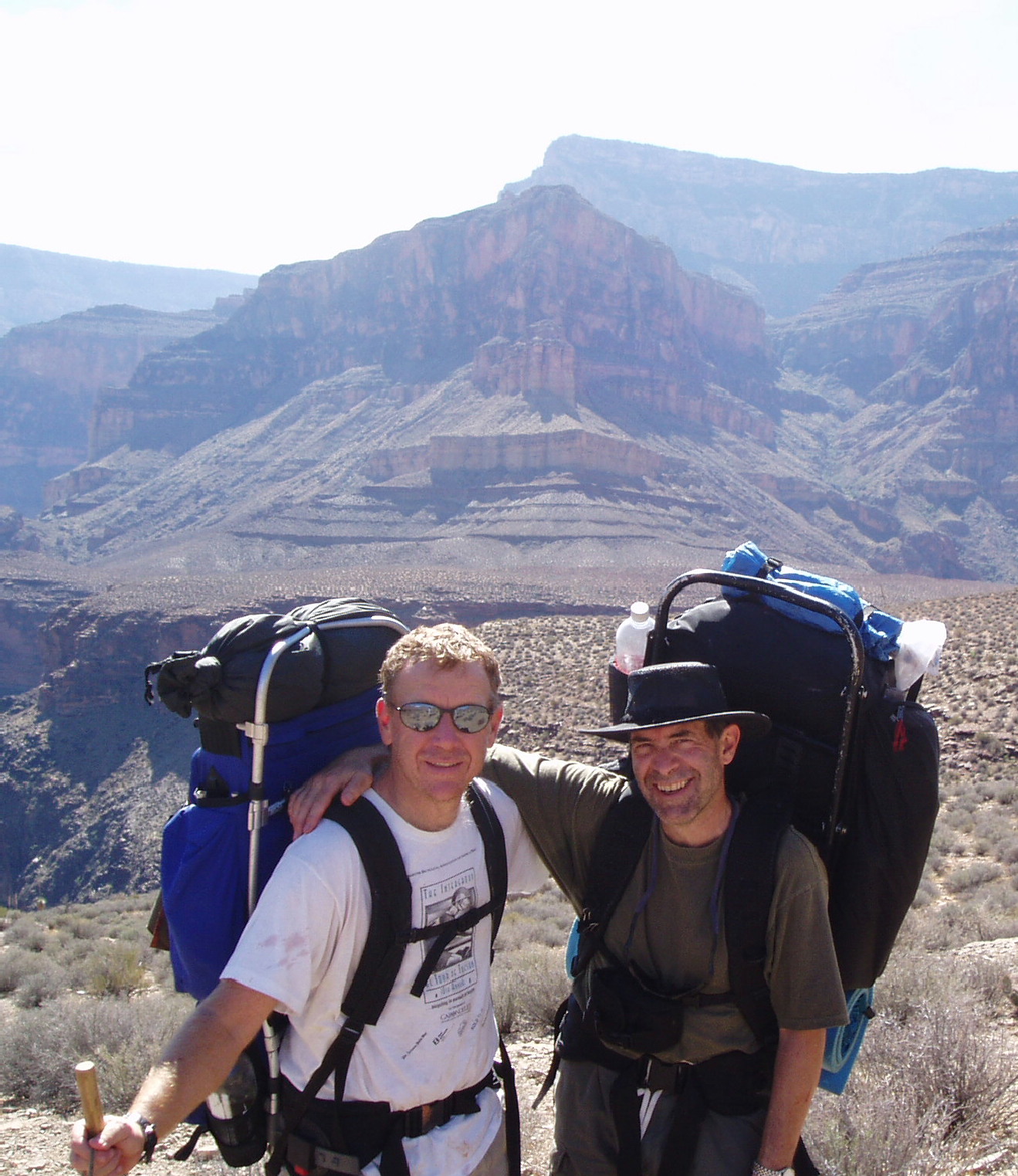
The Hikers: Gary DeFraia, Achilles (“Cheech”)
Calenti, Tom Ralston at the South Bass Trailhead.
Our Trip Plan
Day 1: Hike from the South Bass trailhead to the junction of the Tonto Trail and camp there. Day 2 & 3: Hike and Camp along the Tonto Trail. Day 4: Hike the bottom half of the Boucher Trail to the top of the Red Wall and camp near White’s butte. Day 5: Hike out to the rim via the Boucher Trail, Dripping Springs Trail and Hermit Trail. Mileage would be somewhere between 41 to 44 miles – depending on whom you read.Wednesday, October 1st - New York to Tucson This would be my fifth trip through the Canyon and right from the start, it seemed like it would be the most challenging. We did a similar mileage in 5 nights (see the New Hance, Tonto Trail, South Kaibab trip) so attempting this one in four nights sounded not-too-comfortable. I suggested to Cheech that we either take the extra day in the Canyon or drive to the rim the night before - especially given the remote and challenging access to the S. Bass trailhead. But with Cheech’s assurances taken as Gospel, I went along with the plan to have me fly from New York on Wednesday, meet him in Tucson and drive up early Thursday morning and begin our descent that same day. In retrospect, my view remains the same. If you want to make this hike in four days, get thee to the rim the night before and get a good nights sleep and an early start.
Thursday, October 2nd After only a few hours sleep, we picked up Tom and left Tucson. Due to several wrong turns and eventually making our way to the trailhead on a “less preferred route” (a boulder strewn path - “road’ would be much too kind), it took us three hours travel time from the village, during which I was bounced around like a rag doll in the back of Tom’s trooper. We had inadvertently followed the phone line trail to the junction of the main road to the S. Bass. This road comes out almost directly in front of the ranger station. Normally the trip from the village to the trailhead takes about an hour (~ 30 miles). We suggest you get a map and follow it closely. It is a good dirt road the entire way. (Cheech mountained biked back to get the car at the end of the trip.) Where you enter indian land there is a tent set up. If it is manned (and it wasn't when Cheech drove out) you'll have to pay a toll to cross. Also, driving this road after a heavy rain is not advisable.
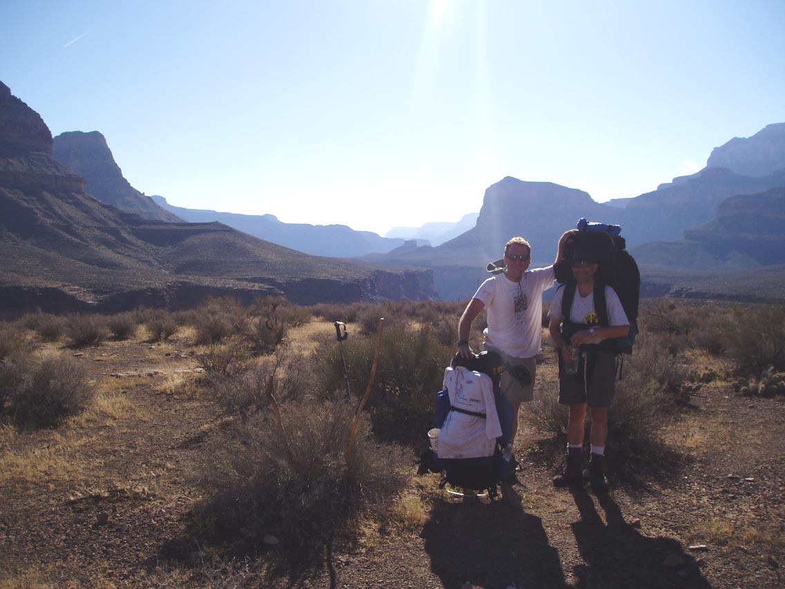
We arrived at the trailhead and unloaded our gear. Tom had some trouble getting his trekking poles to lock but now swears by them as a good way to lessen strain on the knees. Unloading at the trail head.
From the trail-head, across the Canyon, you could
clearly see the smoke from a raging fire on the North Rim. We would
smell it in the Canyon periodically during the trip when the winds
shifted but it was not a problem.
Unloading at the trail head.
From the trail-head, across the Canyon, you could
clearly see the smoke from a raging fire on the North Rim. We would
smell it in the Canyon periodically during the trip when the winds
shifted but it was not a problem.
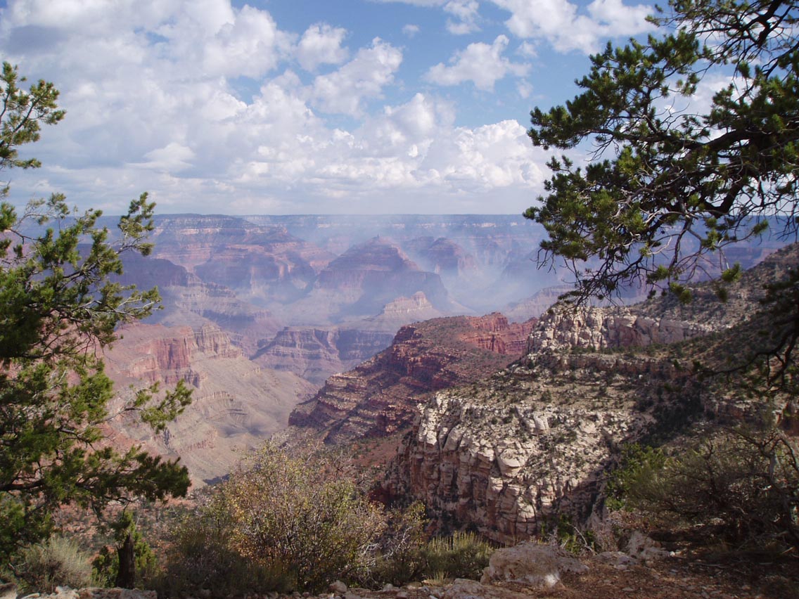 View from South Bass Trailhead: Those are not
clouds in the canyon! It’s smoke from the fire on the North
Rim, pouring into the Canyon.
It took us while to get packed up and we left the
trailhead around 11am. As we
left, I was surprised at how warm it was - 70s. Every other hike I’ve
made was a spring trip and the temperature at the rim was always a
welcomed 45 to 55 degrees. This was very unusual weather.
At any rate, starting out hot seemed to make it hard for me to
regulate my internal heat on this trip…or maybe it was the
lack of sleep or the torturous ride in the Trooper - whatever. During
the afternoon hike I think we made pretty decent time, considering
these initial challenges. One lucky break we did get was the near
constant clouds and drizzle that made for very comfortable hiking
between noon and 4pm. Still, we would barely have enough daylight to
make the junction of the South Bass and Tonto- East Trail.
View from South Bass Trailhead: Those are not
clouds in the canyon! It’s smoke from the fire on the North
Rim, pouring into the Canyon.
It took us while to get packed up and we left the
trailhead around 11am. As we
left, I was surprised at how warm it was - 70s. Every other hike I’ve
made was a spring trip and the temperature at the rim was always a
welcomed 45 to 55 degrees. This was very unusual weather.
At any rate, starting out hot seemed to make it hard for me to
regulate my internal heat on this trip…or maybe it was the
lack of sleep or the torturous ride in the Trooper - whatever. During
the afternoon hike I think we made pretty decent time, considering
these initial challenges. One lucky break we did get was the near
constant clouds and drizzle that made for very comfortable hiking
between noon and 4pm. Still, we would barely have enough daylight to
make the junction of the South Bass and Tonto- East Trail.
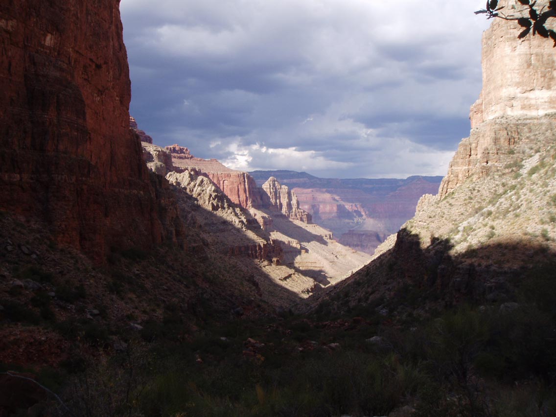 View from the lower South Bass looking towards the
inner canyon. Near the end of the first day, with rapidly retreating
sunlight.
We hiked to within about 15 minutes of the South Bass - Tonto junction
when Tom and I had had enough. The campsite was only marginally
level, but since Tom and I decreed we were not moving another inch,
it was deemed good enough by all. Total miles the first day was about
six. Since it was
threatening rain we pitched the tents – Cheech & Tom in one
tent and myself in a one-man tent. It poured that night but I
welcomed the cool air. I felt fairly ill that night –the result
maybe of some motion sickness from the morning, the hike down or, in
retrospect, not eating enough salts to replace electrolytes.
Friday, October 3rd
The next morning Tom was fairly worn out as well
and we both wondered if we should attempt the trip as planned. Once I
got moving I felt confident it would work out OK. After Cheech &
Tom debated a bit whether we should go down to the river for water,
adding mileage down and back to the junction, we decided to set out
on the Tonto East. We broke camp under cloudy skies and then light
rain.
View from the lower South Bass looking towards the
inner canyon. Near the end of the first day, with rapidly retreating
sunlight.
We hiked to within about 15 minutes of the South Bass - Tonto junction
when Tom and I had had enough. The campsite was only marginally
level, but since Tom and I decreed we were not moving another inch,
it was deemed good enough by all. Total miles the first day was about
six. Since it was
threatening rain we pitched the tents – Cheech & Tom in one
tent and myself in a one-man tent. It poured that night but I
welcomed the cool air. I felt fairly ill that night –the result
maybe of some motion sickness from the morning, the hike down or, in
retrospect, not eating enough salts to replace electrolytes.
Friday, October 3rd
The next morning Tom was fairly worn out as well
and we both wondered if we should attempt the trip as planned. Once I
got moving I felt confident it would work out OK. After Cheech &
Tom debated a bit whether we should go down to the river for water,
adding mileage down and back to the junction, we decided to set out
on the Tonto East. We broke camp under cloudy skies and then light
rain.
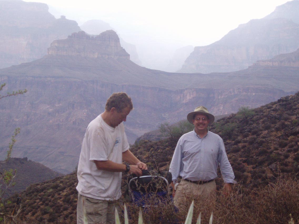 Cheech & Tom breaking first camp on the South
Bass.
Cheech & Tom breaking first camp on the South
Bass.
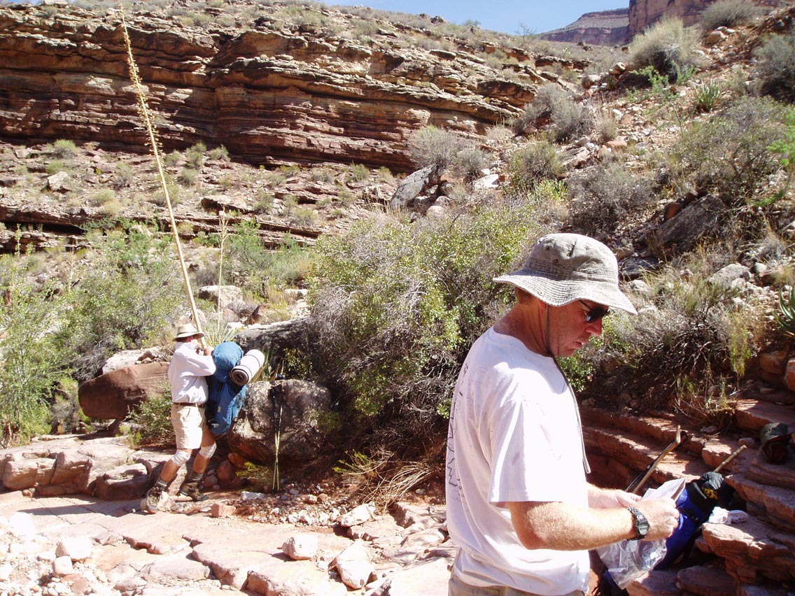
It continued to rain on and off, a blessing first in an immediate way and then later in a way unforeseen at the time. For the immediate, it was a great temperature to hike in. I felt much better once we started hiking. We were heavy with water and the cool rain was most welcome. We had planned to try to make it that day to Turquoise Canyon, a reportedly reliable water source. We made the junction of the S. Bass – Tonto fairly quickly. There are good campsites closer to the junction and some right after the junction. We then hiked through Serpentine, Emerald and Quartz Canyons – these last two are named only in oral tradition. Though they can be found in some guidebooks, they are not on some topo maps. We arrived in Ruby Canyon expecting water and found only muddy puddles, already claimed by tadpoles clinging for life in the quickly evaporating pools. Uncertain of our water sources, we filtered the muddy puddles. It was most unappealing, but healthy enough – none of us got sick. Tom’s Pur filter worked well. As we traversed first Jade and then Jasper Canyons (also canyons not officially named on some maps), it became apparent we would not make Turquoise by dark. We selected a nice site about a mile out of Jasper overlooking the inner canyon.
 Tom- setting up Camp Two on the Tonto
Saturday, October 4th On day three we hiked quickly to Turquoise Canyon. There was again no water, except for the same muddy puddles. We then crossed Sapphire and Agate Canyons These were completely dry. We had hoped to make Slate Canyon, another supposedly reliable water source by nightfall but when we were still about two miles away from Slate by evening, we selected a beautiful campsite out on the Tonto, along the inner canyon near Scylla Butte. It would become the norm that we’d hike all day till near dark – sometimes nine to eleven miles in a day. (*editors note - Though this was Tom and Gary's lament through the entire trip, please note the picture below. We were at our campsite, a spectacular one at that, and the sun is still high in the sky. I think they wanted to sit all day and write the great american novel and debate the merits of various single malt scotches. They didn't get the chance to do that first thing.)
 Cheech, just before setting up Camp Three on the
Tonto-East, near Scylla Butte.
Cheech, just before setting up Camp Three on the
Tonto-East, near Scylla Butte.
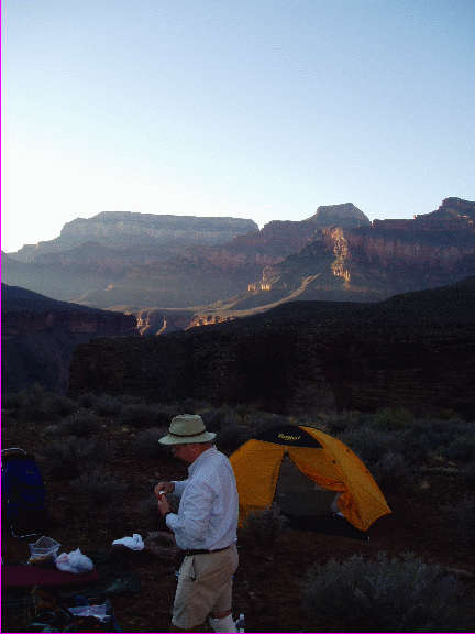
 Gary’s one-man tent on the Tonto.
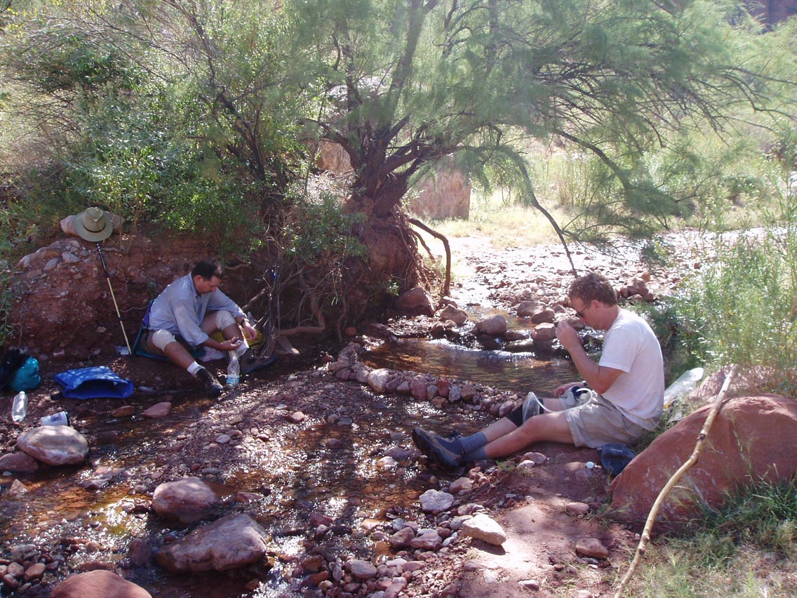
Sunday, October 5th By Sunday we had lost our cloud cover as the weather had completely cleared. This made for better photos and views but also brought the heat. We made it to the head of Slate Canyon in the morning. Once again, - no running water and also once again - only muddy puddles, left from the recent rain.
 Tom & Cheech in Slate Canyon
If we had not gotten the rain we did for the first two days, there would have been no puddles and we would have either had to dig down into streambeds or find the known routes to the river to get water – down either Ruby or Serpentine Canyon. Once we climbed out of Slate Canyon we made good time around Marsh Butte. While the views on the Tonto are routinely panoramic, the views from this remote area are some of the best I have seen to date.
 Cheech and Gary on the Tonto - East of Topaz
Canyon
Cheech and Gary on the Tonto - East of Topaz
Canyon
As we approached Topaz Canyon, Cheech and Tom recalled that it was a difficult descent from the Tonto into Topaz and its confluence with Boucher Creek. (Their memories served them well in this regard though not as well, it seems, in others. For example, they did not recall the 30 mile trek between the South Bass and Boucher to be “this long or tough” when they did it - ten years ago. Tom offered an astrophysical theory that the canyon seemed to be expanding but the more scientific explanation is that the memory of 40 year-old legs differs radically from the space-time reality of post 50-year old legs). At any rate, once the tough descent into Boucher Creek and the challenges of the long daily hikes were behind us, our spirits were lifted greatly at our first (and only) sight of running water for the entire trip – Boucher creek. Though only a trickle or a few feet wide in places and only a few inches deep, it seemed to me one of the most beautiful “bodies” of water I have ever seen. At the junction of Topaz Canyon and the creek, I soaked myself with water and sat in the shade for a while, while Tom & Cheech hiked up the creek to the ruins of Boucher’s stone cabin. I caught up to them a short while later at the small pool near the cabin. It would be too hot to climb out the Boucher in the afternoon, so we planned to rest at the cabin till the sun weakened.
 Tom and Cheech at the small pool near Boucher’s
cabin
Tom and Cheech at the small pool near Boucher’s
cabin
After a glorious rest with all the fresh water we wanted, we set out to climb the Boucher Trail to the Red Wall. The elevation change from Boucher’s camp to the top of the Red Wall is about 1400 feet over very few miles. The trail is sparse in some places and always steep, making it pretty tough. I lost the trail a few times and at one point even Cheech followed the Tonto by mistake. (He quickly realized it was wrong because it was flat!) I fell behind and it was nearly dark by the time I made the top of the Red Wall (to loud applause and cheers – Cheech had seriously wondered if I would make it before dark. Since there is absolutely no place to camp on this leg of the Boucher, I was very pleased to arrive. Although this section was very tough, it did not live up to the hype of some reports I read - in terms of dangerous drop-offs or intimidating “edge-walking”. Our campsite was near White’s Butte, one of the most beautiful places I have encountered in my Canyon travels. (It is certainly possible I was overly influenced by the fact I now knew I was going to live and maybe I overestimated the beauty of this site – but the photos seem to support my initial view).
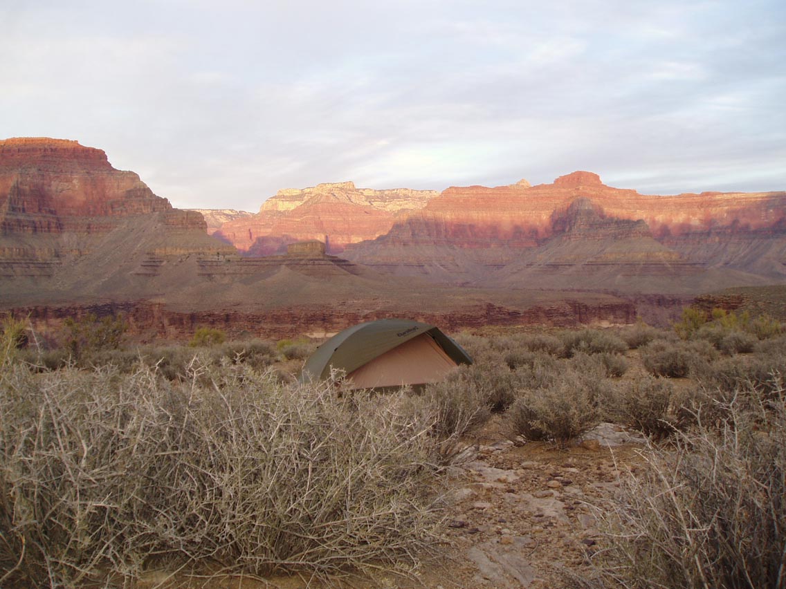
 Sunset at Camp Four on Sunday night, near White’s
Butte
Sunset at Camp Four on Sunday night, near White’s
Butte
For the first time on the trip we did not pitch tents and it was one of the most memorable evenings I’ve had in the Canyon. Beautiful sunset, stunning stars and pleasant sleeping.
Monday October 6th The next morning was a gorgeous one. We packed up early to make our “dash” to the rim. This section of the Boucher – from the Red Wall to the rim - also did not support the exaggerated descriptions of dangerous sections of the trail. Sure, it is pretty tough from the Red Wall to the junction of the Dripping Springs Trail – but due to elevation change and the primitive condition of the trail - not because of intimidating stretches. (and you can believe me. I am not at all brave when it comes to skimpy ledges with precipitous drop-offs!)
The contour around Yuma Point to the junction of the Dripping Springs Trail felt like it went on forever, but we made good time. Tom passed me on this stretch and was almost out of water so I gave him some of mine. He noted we would be able to get water by hiking down the Hermit to the Santa Maria Spring. Once on the Dripping Springs Trail it was a relatively short distance to the junction with the Hermit Trail. Cheech and I took a break here while Tom went down to the spring. It was further than he thought and the water was dirty and barely a trickle but he came back with enough for all to filter for the trip out. Cheech made the rim by about 2:15 pm while Tom and I came out together around 3.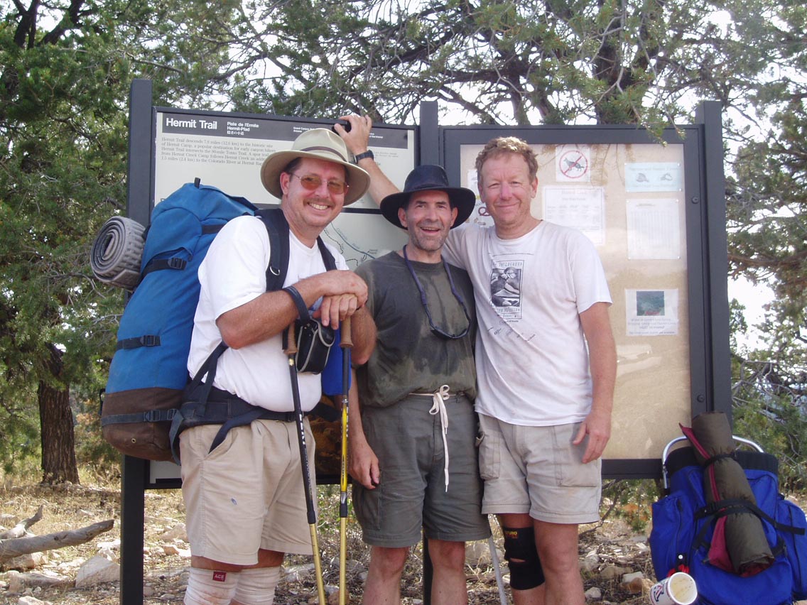
Note: The “Direction Debate” I have read several trip notes and they do not all agree on the preferred direction to make this hike. Some say its better to go East to West, down the Boucher and up the South Bass while others say the opposite is preferred. My vote is clearly for the direction in which we did it – West to East. Most of the trip would work fine in either direction, but due to the condition and the slope of the trail between Boucher Creek and the Red Wall, I clearly prefer an ascent. Having climbed up it with a light pack, I would not recommend going down it with a heavy pack. Also, the time of year would seem important for this specific route. It should be done in the spring when there are more run-offs and a better chance of running water in the side canyons. Cheech and Tom’s last trip on the same route was a spring trip and they had no problems with water. While this trip was not very leisurely and left little very time in camp to enjoy the company, it was a very satisfying trip in terms of having successfully traversed one of the more challenging routes the Grand Canyon has to offer. As always, many thanks go to Cheech and Tom for their guidance, being great “pards” and good friends. I look forward to the next trip for which I will yes, be both older, but also - wiser.